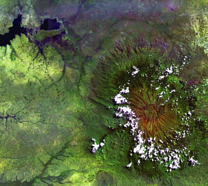
The world’s vegetation is in constant motion: growing, retreating, adapting to the rhythms of climate and human activity. Yet much of this transformation escapes the naked eye. Understanding how landscapes evolve has never been more important, especially as we face mounting environmental challenges.
Satellite imagery offers a way to bridge this gap. From hundreds of kilometers above, it captures the living patterns of our planet, revealing changes that are too gradual or too vast to see from the ground. By tracking vegetation from space, we get not only a clearer picture of the Earth’s health but also a better chance to protect it.
NDVI Imaging
Among the many tools that satellites use to monitor vegetation, NDVI satellite imagery stands out as one of the most powerful. Short for Normalized Difference Vegetation Index, NDVI is a method that measures the vitality of plants by analyzing how they reflect light. Healthy vegetation absorbs most visible light and reflects a large portion of near-infrared light. By comparing these two types of reflection, NDVI creates a simple yet telling indicator of plant health.

Image: NDVI Calculation Source:EOSDA
At first glance, an NDVI map may seem abstract, a patchwork of colors stretching across the landscape. But behind these colors lies a deep story about the state of our fields, forests, and grasslands. Vibrant greens often signal areas of strong, healthy growth, while paler shades or brown tones may point to stress, drought, or disease. This kind of insight allows scientists, farmers, and conservationists to respond more quickly to emerging challenges and better manage natural resources. By translating invisible patterns of light into visible signs of life, NDVI mapping helps turn raw satellite data into meaningful insights.
The Power of Satellite-Based Vegetation Monitoring
The real strength of satellite-based vegetation monitoring lies in its ability to deliver timely, precise insights that traditional methods simply cannot match. One of its most important advantages is the ability to detect land clearing almost as it happens. Near real-time clearing detections give land managers and environmental agencies a crucial head start, helping to prevent illegal deforestation or respond quickly to unexpected land use changes.
Beyond just watching for loss, satellite imagery offers a powerful lens into the health of living ecosystems. Precision vegetation health assessment enables a far more detailed understanding of how plants are coping with environmental pressures, from droughts to pests, long before the damage becomes visible on the ground. This level of detail is not only valuable for agriculture and conservation, but it also plays a growing role in climate action efforts. Satellite monitoring strengthens carbon project verification by providing objective, wide-scale evidence of vegetation growth and changes in biomass, making carbon credits more reliable and trustworthy.

Image: This NDVI comparison captures how vegetation changes with the seasons. During peak growth, fields light up in green. A few months later, much of that energy fades — and satellite data shows it clearly. Source:EOSDA
At the same time, technology is becoming an essential tool for managing emerging ecological threats. It supports efforts to track invasive species as they spread across landscapes and helps assess fire risks by monitoring the conditions that lead to dry, combustible environments. With a continuous, high-level view of plant life across vast areas, satellite-based vegetation monitoring gives scientists, policymakers, and businesses the ability to act faster and more intelligently in protecting and managing the natural world.

Via USGS
Industry Applications
The insights offered by satellite vegetation monitoring are not confined to scientific research or conservation alone. A wide range of industries are now using this technology to strengthen operations, reduce risks, and plan for the future with greater confidence.
In agriculture, satellite-based monitoring supports smarter farm management by guiding irrigation schedules, optimizing fertilizer use, and predicting harvest outcomes. Tools such as NDVI maps allow growers to visualize crop health across entire fields, helping them make more precise decisions that boost yields while conserving resources. In forestry, companies rely on vegetation data to oversee vast tracts of land, ensure sustainable practices, and meet certification standards that demand rigorous environmental stewardship.
Mining companies also turn to satellite imagery to monitor land conditions around extraction sites, helping to manage environmental impacts and ensure compliance with land rehabilitation requirements. Tracking changes in vegetation offers a clear, ongoing record of how operations affect surrounding ecosystems, supporting more responsible resource management.
Infrastructure and energy sectors are finding value in vegetation monitoring as well. Utility companies use satellite data to track vegetation growth near power lines and pipelines, helping prevent service disruptions and minimizing fire risks. For developers and land planners, having up-to-date vegetation maps is key to designing projects that balance progress with ecological responsibility.
Meanwhile, environmental protection agencies are integrating satellite insights into their strategies to preserve biodiversity and restore damaged landscapes. Monitoring vegetation health over time allows them to identify areas in need of urgent intervention and to measure the success of conservation initiatives with greater accuracy.
Even the insurance and finance industries are tapping into vegetation data to improve natural hazard risk assessments, influence lending decisions, and support sustainable investment strategies.
Across all these fields, the common thread is clear: access to reliable, timely information about vegetation helps businesses and institutions make smarter decisions, respond faster to challenges, and operate more sustainably in a rapidly changing world.
The post Tracking Vegetation With Satellite Imagery appeared first on Moss and Fog.